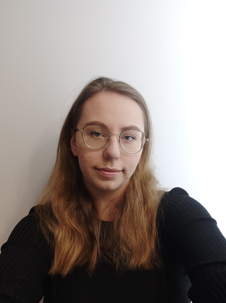
Profile's image

Hello, my name is Aleksandra Wasik.

Nice to meet you.

Remote sensing enthusiastic, geodesist. Specialization: photogrammetry, remote sensing and geographic information systems (GIS). I am enthusiastic to learn and undertake new challenges. Feel free to contact me.

About me

My specialization is photogrammetry, remote sensing and geographic information systems. I associate my future with geospatial data and my professional interests are strongly related to remote sensing and GIS applications. I am interested in remote sensing applications in environmental monitoring and GIS applications in smart city and nature studies. My interests revolve around human-environment relations, including a focus on sustainability, shaping the space around people and the resilient city in terms of climate change. I am open to the world, knowledge and looking for new opportunities.

I have experience in teamwork and can work independently. I am a task-oriented type - I set measurable goals in my work and achieve them. I am rational, concrete and well-organised. I can cope well with tasks that require focus and logical thinking.

In my free time, I follow Formula 1 racing and am interested in make-up and skincare. I enjoy relaxing with ASMR videos and reading books, mainly historical novels, thrillers and non-fiction. I participate in language tandems in English.

I am enthusiastic to learn and undertake new challenges. Feel free to contact me.

My e-mail: aleksandramonikaw@gmail.com
Present project

Prizes and awards

Poczuj miastozen w Kielcach - w równowadze z mieszkańcami (PL)
Feel the city-zen in Kielce - in balance with the citizens (EN)

1st place in the competition "Webskie Kielce. Datathon Idea Kielce 2022" organized by Kielce City Hall.

category: Kielce - a city space in a new form

This is a team work that I was the leader of. Our work focused on testing the concept of a 15-min city for 3 age groups. We used grid analysis to see which neighbourhoods in the city provide the residents' needs within the 15-min. We showed using a hexagonal gridwhere access to selected services and residents' needs are lacking. We proposed a completeness index as an indicator of quality of life in the hexagonal grid. We suggested other data sources and next actions. The maps were created in ArcGIS Online and ArcGIS Pro Desktop. We carried out the analyses using ArcGIS and QGIS. Processes were automated using graphical models.

Nowe rowerowe Kielce (PL)
New cycling Kielce (EN)

1st place in the competition "Webskie Kielce. Datathon Idea Kielce 2021" organized by Kielce City Hall.

category: "Let's play at building a better Kielce for the next generations"

This is a team work that I was the leader of. The work focused on checking access to sports facilities around schools by bicycle. The main aim was to present the current cycling situation in the city and to propose indicators to check the development of cycling infrastructure in the city. We proposed other sources of crowdsourcing data and the possibility of combining different data to create other indicators. The maps were created in ArcGIS Online and ArcGIS Pro Desktop. We carried out the analyses using ArcGIS and QGIS.

Diageo's best promoter in 2019

I was the best Diageo brand promoter in Poland in 2019 for the highest sales of products from the Diageo brand portfolio.

Skills, software & data source

software

  • ArcGis Pro - advanced
  • ArcMap Desktop - advanced
  • QGIS - advanced
  • Erdas Imagine - intermediate
  • SNAP - basic
  • Agisoft Metashape - basic
  • Pix4D - intermediate
  • AutoCAD - basic
  • Geo-Info - basic
  • C-GEO - intermediate

Data I worked on

  • Vector database
  • Rasters
  • VHR, HR satellite images - CORONA, Landsat, Sentinel
  • Aerial & UAV photographs
  • SAR images
  • Laser Scanning data

skills

  • Driving license
  • Python - learning
  • R - learning
  • UML
  • SQL with PostGIS

Languages

Polish - Native speaker

English - Communicative/Intermediate - B1/B2

German - Elementary/Communicative - A1/A2

I develop my languages skills in tandems in English. I take part in the Enhance Tandems WUT project.

Experience

2022-01 - Present Jagiellonian University, Poland
Institute of Geography and Spatial Management, Faculty of Geography and Geology
Position: Master Student Researcher
Research project: Trajectories, causes and effects of land cover and land use changes in Central Europe (TRACE)
Project description on the NCN website
  • grant from National Science Center (no.2018/29/B/ST10/02979)
  • Work on a pathway using satellite data to assess land cover changes
  • Work on the orthorectification workflow for CORONA images
  • Satellite data integration: CORONA, Landsat (MSS, TM, +ETM, OLI, OLI-2)
  • Study of the human-environment relations
  • Writing a master's thesis on land cover change using object-oriented classification and machine learning methods
  • Writing a scientific paper in an international journal
  • Software: Agisoft Metashape, Google Earth Engine, QGIS, ArcGIS
2020-09 - 2021-03 19E sp. z o.o., Poland
Position: GIS Operator
  • Spatial data processing: vectorization of raster maps
  • Creating database of geodetic resource: mapping of geodetic documentations
  • Software: Geo-Info, Ewmapa
2020-07 - 2020-07 Institute of Precision Agriculture sp. z o.o., Poland
Position: GIS Analyst - Internship
  • Processing of photogrammetric material
  • Production of an RGB orthophotomap using UAV photogrammetry
  • Determination of vegetation indexes
  • Software: Pix4D, QGIS
2019-08 - 2019-08 Geolidar Geodetic Services, Poland
Position: Assistance surveyor – Internship
  • Update of the master map
  • Staking out underground utilities network and buildings
  • Drone flights
  • Production of an orthophoto map using UAV photogrammetry
  • Software: AutoCAD, C-GEO, Pix4D

Education

2021-02 - present Warsaw University of Technology, Faculty of Geodesy and Cartography, Warsaw, Poland
Master of Science in Engineering, Geodesy and Cartography
  • Spatial Information Systems
  • 2022-08 - 2022-08 Karlsruhe Institute of Technology - Campus Alpin, Institute of Meteorology and Climate Research,
    Garmisch-Paternkirchen, Germany
    Summer School on Land Use and Ecosystem Change
  • Topics: a wide range of issues related to land use change, socio-ecological systems, ecosystem functioning, biodiversity, ecosystem services, science policy
  • "Alone we are smart, together we are brilliant"
  • 2022-03 - 2022-04 Vilnius Gediminas Technical University, Faculty of Architecture, Vilnius, Lithuania
    Erasmus Blended Intensive Programme
  • Smart Community Workshop
  • Topics: What does it take to build a smart community? A variety of aspects of the community in relation to city planning, urban design, creative industries, mobility and sustainability issues, spatial design and open data
  • "Alone we are smart, together we are brilliant"
  • 2017-10 - 2021-02 Military University of Technology, Faculty of Civil Engineering and Geodesy, Warsaw, Poland
    Bachelor of Engineering, Geodesy and Cartography
  • Photogrammetry, remote sensing and geographic information systems
  • Thesis: Using remote sensing methods for monitoring drying lakes (Landsat, Sentinel data)
  • member of Student Council of the Faculty of Civil Engineering and Geodesy: helping students with the organisation of remote study at home, suggestions for a new study programme
  • My portfolio online

    Projects at Warsaw University of Technology

    • Creation of a geoportal using the Leaflet library
    • Development of the application "Assessment of housing location attractiveness" for the city of Olsztyn
    • Assessment of the attractiveness of the view from selected flats of the designed skyscraper and its impact on the surroundings - shading visibility analysis
    • Estimation of solar potential of roofs for a part of Warsaw on the basis of LIDAR data
    • Mapping of migration corridors on the basis of land cover maps and habitats of large predatory animals
    • Designing a database for teams in shooter games with UML
    • Creating a simple printer plugin for QGIS
    • Urban heat island of Wrocław in 2010, 2019 and 2021 based on satellite data
    • Determining the value of the quality index in the city of London (Canada)
    • Indication of the optimal location for a hotel investment
    • Interpolation of concentrations of air pollutants in Poland
    • Change detection in Urban Area based on DSM from aerial photographs and the ALS point cloud
    • Network analyzes on a selected topic: Participation in a city game
    • Dynamic analysis (Geomedia) on a selected topic: Choosing a city for student internship in the USA

    Projects at Military University of Technology

    • Production and accuracy analysis of orthophoto map and digital surface models using UAV photogrammetry
    • Detection of energy infrastructure elements on UAV image using the algorithm developed in Python
    • Geodetic preparation of the land use project
    • Change detection in Urban Area from high-resolution remote sensing images
    • Development of a 3D model of the building from terrestrial laser scanning data
    • Modernization of the land register on the example of a selected area of the register
    • Analysis of the distribution and density of the settlement network in a selected administrative unit
    • Production of an orthophoto map based on a block of aerial photos
    • Creating a qualitative thematic map based on own data